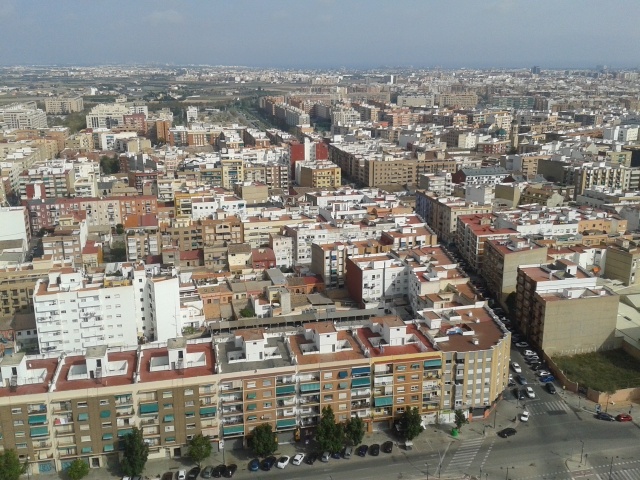
Leave the past under a carpet of cement
FC-01x Future Cities (1st Run) - Exercise 1 : "Making the Invisible - Visible"

Uploaded on 2014-10-21 by Manualej
[1]: https://edxuploads.s3.amazonaws.com/14139135217074736.jpg *This picture was taken from the terrace of Hotel Eurostars Gran Valencia, overlooking the roundbout at the intersection of Carrer de la Safor and Av. De les Corts Valencianes, at Benicalap, Valencia (Spain).* We find the limits of what is considered the city of Valencia. As visible aspects we see a lack of principals courts, so it is given a much lower level of traffic compared to the center. Benicalap district was a village that was annexed to the city in the late XIX century, but continue with the same flow commercial low and touristic, and it’s because didn’t incorporate any equipment or large projects. You can also see part of the garden at the back on the left, showing how it is surrounded and showing in which direction it will grow. Broadly, the most important invisible information to note is its relationship with the garden. Benicalap and planning organization based in the Rascanya ditches, resulting paths to the garden respecting that, but when it was absorbed this relationship started to disappear. The general planning regulations in Spain, 10% of the floor area asks whether public green areas and open spaces, but this is only true if you have spaces more than 5 km from the city limits, and this is a problem that affects the interests of the population is now in these limits and still want to meet nature with a carpet of cement, and forget what Valencia represented before.