Invisible | Visible
FC-01x Future Cities (1st Run) - Exercise 1 : "Making the Invisible - Visible"

Uploaded on 2014-10-23 by stuartmacdonald
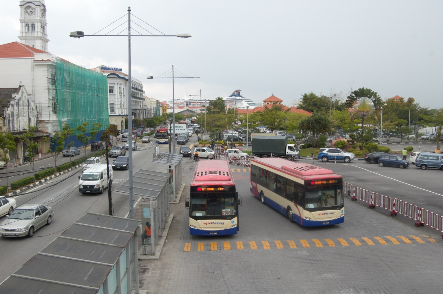
**Visible information** There is a vast amount of visible information in this photo. The built environment provides information about the locations history for example. The clock tower in the photo is of the Wisma Kastam building, originally known as the Federated Malay States Railway Station, and later the Malayan Railway Building, and is one of the most prominent heritage buildings along the Weld Quay waterfront of George Town. It was built at the turn of the 20th century. The photo highlights the urban form and through the street design and layout we can observe the balance of space allocation between vehicular and pedestrian traffic. Given that this is a public transport terminal we can observe the lack of infrastructure available for pedestrians, noting that the bus stops appear as islands in an environment completely designed for the vehicle. **Invisible information** The invisible information in this photo that can most usefully be made visible stem from vehicular movements. As an integrated public transport terminal (Bus/Ferry) both private vehicles and public buses enter the terminal grounds, and both provide sources of data that can be utilised as knowledge to make the space more liveable. The ferry terminal collects data on the number and type of vehicles boarding the ferry and is therefore aware when the ferry is operating at full capacity. The ferry company could better use this data to provide capacity to match demand, so that ferry frequency is increased in response to demand, which may be able to prevent the vehicle queue extending into the main carriageway, causing congestion and a hazard for pedestrians attempting to cross the street, as demonstrated in this photograph. Every public bus is fitted with a GPS tracker which allows the bus company to track the movements of the vehicle. This information is utilised in a publicly accessible displays/website/app to provide estimates of vehicle arrival time. However, these time estimates are based on a calculation of distance and therefore are significantly inaccurate when the traffic is heavy. These estimates could be vastly improved if the calculation was based on real time traffic conditions, using data from other GPS trackers from across the bus fleet (so how long did the previous bus take to travel this distance), and potentiality from private vehicle users (applications such as Waze are open source and is increasingly being utilised by transit authorities). ![enter image description here][1] [1]: https://edxuploads.s3.amazonaws.com/14140292222532604.jpg