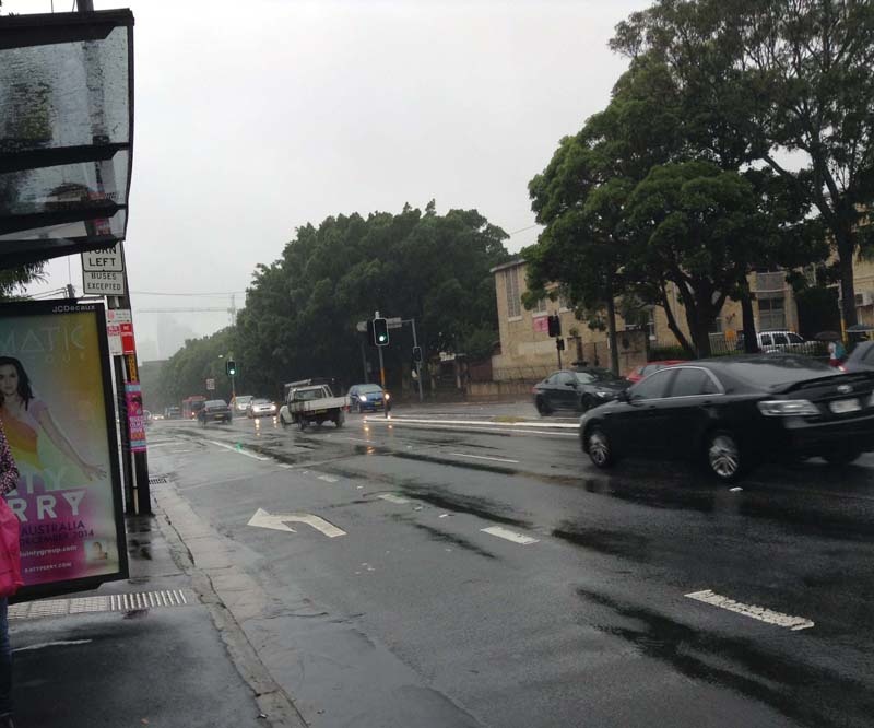
Sydney – a major thoroughfare
FC-01x Future Cities (1st Run) - Exercise 1 : "Making the Invisible - Visible"

Uploaded on 2014-12-06 by Urban15
[1]: https://edxuploads.s3.amazonaws.com/14178560193838027.jpg 1. This image taken at 930am during a business working day, shows a busy thoroughfare in Sydney, Australia that leads from the South West towards the City of Sydney. The buildings in this area are on an average two to three storey’s high and date from mid to late 1800’s from Victorian to Federation style. The road in both directions change from two-three lanes. This image shows the traffic moving at a steady pace during off-peak time. There are bus stops on both sides of the street with traffic lights at major intersections. The City can be seen in the background with high-rise buildings. 2. One invisible information is that during peak time in the morning this road heading into the City is congested because all the traffic backs from the City. In the afternoon this road is congestion as all of the traffic trying to leave the City back up into this road. Another piece of invisible information is that there is a lack of parking around this area for cars. There are paid time limits for parking in this area. 3. By monitoring the traffic flow in this area at different period of each day and also different days of the week city planners could use the information to plan better public transport from outer areas of Sydney to the City each day. Surveys could be done to ascertain who uses this area of road, where they are driving from and to and when do they use the road. The public transport available at the present time is just adequate, buses can be crowded at peak times and during off-peak times public transport can be infrequent. What would better suit this area would be to have an only bus lane all the way to and into the City to make the journey quicker for the passengers and to encourage people to use more public transport and keep cars and motorbikes off the road.