Optimising Critical Services (Hong Kong)
FC-01x Future Cities (1st Run) - Exercise 1 : "Making the Invisible - Visible"

Uploaded on 2014-10-18 by agmhk
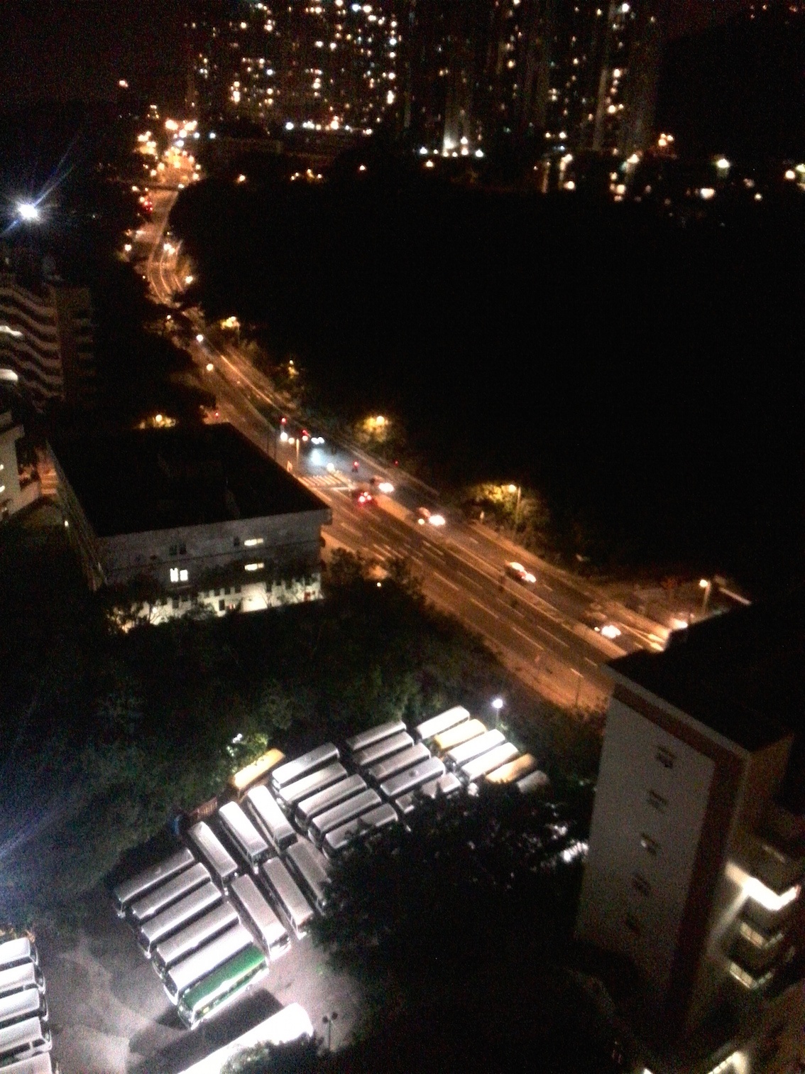
[1]: https://edxuploads.s3.amazonaws.com/14136508941289108.jpg a. Building Top LEFT (with bright light on top) is a school. b. The building underneath it (square) is a fire station and Ambulance Station c. The next feature below that is the carpark for the busses for the other school (d) which is at the bottom right of the picture. e. Top centre and top right are skyscrapers (urban dwellings). f. The road you see goes all around HK Island one end to the Tunnel into Causeway Bay, the other towards HK University. Traffic related flows, there is a traffic light seen and an existing camera beside it. It is clear that one direction is busier than the other at this particular time. Using the traffic camera or using a sensor could give the obvious traffic flow rates in real time. (the camera could also be used to track vehicle registration numbers if we want to go down that route). The traffic here is congested at peak times and faster flow for the rest of the day. Pulling this data will yield statistical models of the traffic flow and better knowledge of traffic behaviour. Camera pattern recognition or road sensor could determine the "mix" of vehicles, e.g. bus, lorry, car, motor bike etc. This data also can contribute towards pollution planning. Optimising Location and Response time of emergency services. The quality of service from a fire station or ambulance centre is the response time. The response time is heavily dependent on location and of course traffic congestion. The data of response times is present hidden inside this building. Using the traffic data we can statistically determine if it is the best station to respond at various traffic states. Monte Carlo modelling could determine whether the present location is optimal or whether the surrounding population would benefit from this service (or building) being relocated in order to improve response. Schools. School location is important, again we have inside these buildings data on where the children reside, modelling could determine whether the school is optimising their bus service. Again monte carlo modelling could determine optimal route planning (again which would be pegged to statistical data on traffic conditions). Data on the geographical spread of the children's home address could be used for government planning on school location and using this against population statistics and planned urban development determine optimal location of future schools AND their optimal size. From this we also get water budget and power budget for planning.. We also can calculate carbon footprint from this data which helps towards sustainability. Power (Sustainability) The largest component of energy use in a building is air conditioning which represents perhaps 70& of the energy consumed (lighting is perhaps 10%). The data of real time power usage in all these buildings in the photo are available inside the buildings (and with intelligent power meters increasingly available to power company), real time usage statistics could help better plan micro grids in the future as generation becomes more localised as well as optimise sustainability by ensuring Air conditioning is being used effectively and only when it is needed. Moving one stage further room by room usage knowledge in real time again helps model and optimise efficiency and sustainability inside the building. More power is consumed on the sun side of a building, so the heat loading is a statistical useful feature to set optimal temp settings on air conditioning system which again can be extracted. Heat Loading and local weather conditions including light luminance. There is a small weather station sensor not shown at night on the school. This, if networked or expanded on a larger scale, could produce more accurate heat loading data on the buildings and help determine whether power consumption will statistically rise in the area. Again useful for sustainability and building design, in a school optimising natural light while minimising heat load. Naturally colocating a pollution sensor would yield useful planning data if part of a larger system.