EXERCISE 1: MAKING THE INVISIBLE VISIBLE- ETHIOPIA | THE MERKATO MARKET
FC-01x Future Cities (1st Run) - Exercise 1 : "Making the Invisible - Visible"

Uploaded on 2014-10-13 by DBRMIC011
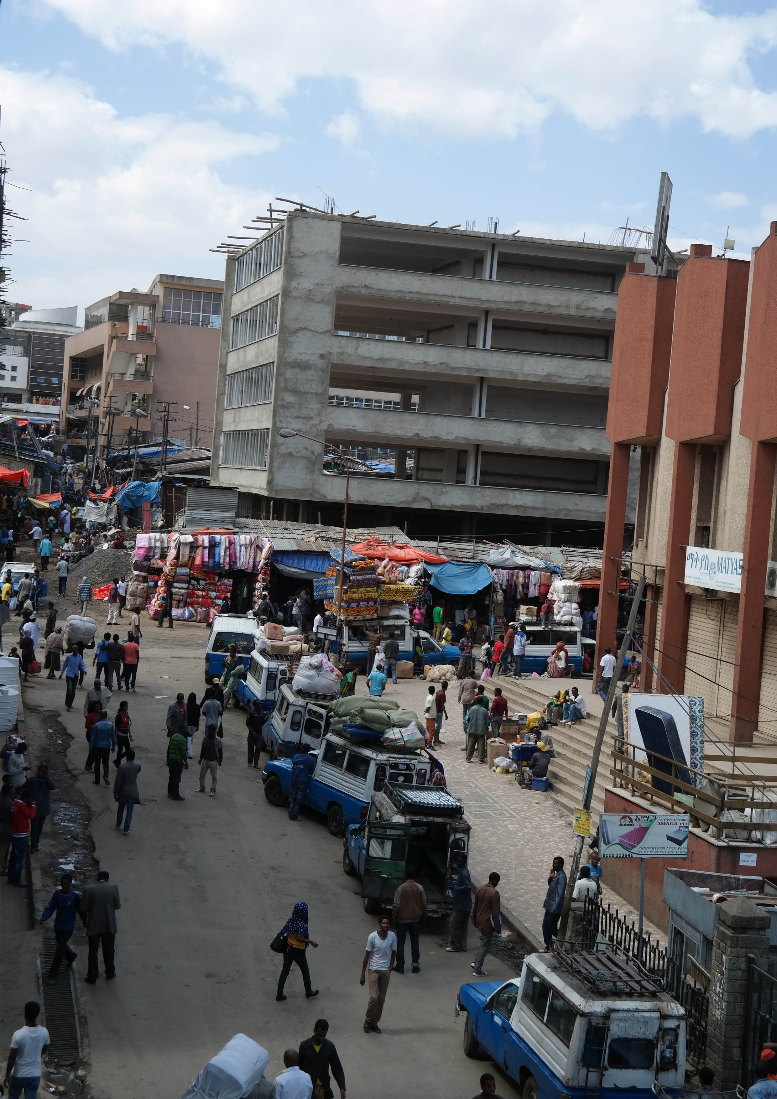
The photo had been taken during a two month trip through Ethiopia and it is of the Merkato market. Said to host more than a million people a day, but is this true? For this exercise although only two examples of making the invisible visible was required, I will present four which are interrelated and presented in two headings; namely **use and movement** (how people use the city); and **city Framework** (the physical make up of the city). **Use and Movement** **1. Taxi's:** Taxi's (the blue and white vehicles) are used for both people and the distribution of goods. There movement is key to understanding how people move and use the city. If data of there movement can be geo-located it will enable relationships between areas of the city to be identified, representing both trade and movement of people (As seen in the Singapore Case, this may enable the ability to identify how people and trade is occurring in the highly choatic and sprawling market) **2. Cell Phone data:** Smart phones, becoming evermore accessible to Ethiopians may be a key source for data. It enables the possibility to geo-locate movement, as well as geo locate social media content. It offers a view of the city specific to use of the city and there association to place. **City Framework** **3. Building permission:** In Ethiopia, buildings need permission to be built, like many other countries around the world. This fundamental administrative function enables the ability to understand the city better. Private development offers a unique understanding of the city due to the need for feasibility, they do not invest if the risks of not making a return is to high. Ie. private development responds to opportunity. Several forms of information may be extracted from this; namely where certain typologies of buildings are being built and secondly the ability to understand types of aggregate formation that may be occurring naturally enabling the ability to preempt nodal and corridor formations. **4. Application for use:** If you intend to use a space for a specific use this needs to be processed through an application of approval. very simply, it enables the possibility to geo-locate types of uses occurring, ie. banks, shops extra. **Synthesis!** The data collected offers very specific views of how people are using the city.If synthesized/ overlayed a new picture is created, one of relationships. one may be able to draw relationships between the movement of people and formation of nodes and clusters of development enabling the possibility to be able to preempt where city growth may occur before it happens. A key application for this would be for the provision of infrastructure, linking typologies two certain capacity provisions for infrastructure. What these relationships will also indicate is existing nodes which previously had not been identified and more specifically related to the merkato, enable a clearer understanding of both how the highly informal area is being used and how development is responding. [1]: http://media-cache-ec0.pinimg.com/originals/53/3d/1a/533d1a11a7396e185b7a504524b9cf30.jpg