Invisible information in Barcelona
FC-01x Future Cities (1st Run) - Exercise 1 : "Making the Invisible - Visible"

Uploaded on 2014-10-18 by RiccPala
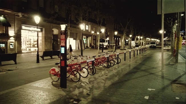
This photo was taken in the city center of Barcelona. The street is Paseo de Gracia, just in front of the Pedrera of Gaudi and shows one of the numerous stations of the public bike system around Barcelona. Next to the station we can see a track that can be used by cars and pedestrians with 30 km/h speed limit, where the pedestrians have the preference. Finally we can see the beauty of this street, with nice lamppost and pavement and luxurious shops. Paseo de Gracia is one of the most famous commercial streets of the city, being highly used as much for the local people as for the tourists. Regarding the invisible information that can be extracted out of the picture could be the traffic of bikes in big cities and the traffic of people in commercial streets highly The picture was taken around 10 pm and we can see how the bike station is quite empty. The users can take the bikes and leave them in other stations, but sometimes you cannot leave the bike in the station next to your destination as it can be full. The bike station then shows you the free places of other station of the surrounding area. As invisible information we could know the flow of bikes, trying to find a way to study the traffic of private bikes. It could be possible to know when and where the bikes where taken and left, how long every bike has been used, improving their maintenance and the revision. Regarding the 30 km/h speed track, it is evidence as how the city has to observe the needs of the citizen. In these streets, cars and pedestrians can walk, improving the fluidity of the traffic. As there are not many streets like that, we can see as invisible information that streets that can be used by bikes, cars, buses and pedestrians needs to evolve in order to adapt themselves for a better utility. The invisible information about the bikes traffic could contribute to the planning of a more liveable urban space. The use of bikes is constantly increasing in Barcelona and in other cities. By tracking the movement of every single bike, we could for instance analyze the more used stations, improving the service offered by refilling or emptying some stations. But regarding the contribution to the planning of the city, the information could be used for the planning of cycle lanes. If it is possible to know were the bikes are going, it would be possible to offer cycle lanes to improve and make more safety the traffic in bike. Pedestrians and car have already they own place in the street, whereas the bikes can use both kind of ways, driving with the cars or among the pedestrians. [1]: https://edxuploads.s3.amazonaws.com/14136629106603295.jpg