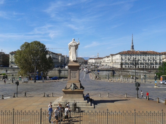
Torino, new challenges for post-FIAT era...
FC-01x Future Cities (1st Run) - Exercise 1 : "Making the Invisible - Visible"

Uploaded on 2014-10-09 by MonikaLove
the visible: - the city is nearby snowy mountains situated at a riverbed; - the city might be located in the southern region of europe as it is built on traditional city plan - the classical buildings surrounding a square with the street on axis probably leading to the main square; the photo is clearly not from centre yet… - there seems to be a covered walkway on the side of the buildings surrounding the square - the centre is probably rather old and with some importance in the region; it has also quite a few higher towers - churches? - the city is car-oriented - though one can see bike rental on the right side of the river, there doesn’t seem to be a bike lane?! - it lacks of green space invisible: infrastructure - cars, trams, bicycle networks, pedestrian movements environment - water pollution, river usage as public space, connections to other cities and transport networks; trees, green networks - air pollution, flooding if further data was available one could learn about: - Looking at the networks of movements one could learn both the traffic hotspots (rush hour, multimodal transport system); - but also plan ahead what would be needed in case of flooding from the nearby river. - how could more green infrastructure improve the air-quality of the city? ![which city is that?][1] [1]: https://edxuploads.s3.amazonaws.com/14128810417420124.jpg