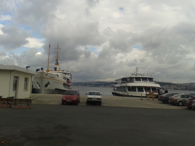
Invisible Information on the Bosphorus, Istanbul
FC-01x Future Cities (1st Run) - Exercise 1 : "Making the Invisible - Visible"

Uploaded on 2014-10-19 by robinhinkley
This photograph is taken from the European side of Istanbul, looking over the Bosphorus Strait to the Anatolian side of the city - the crossing between one continent and another within a single city. There is a fairly limited amount of visible information within this photo, but one can see two main transport options for crossing from one side to the other - by ferry and by a vehicle bridge (in the background of the photo). One can see the density of building on the Anatolian side. Other visible information includes the weather at the time the photo was taken as well as the sea conditions. The density of sea vessels on the strait, and the density of traffic on the bridge can also be observed. All of these pieces of visible information can also be measured and recorded on an ongoing basis. There are a number of invisible pieces of information that can be extracted from the visible information here. One is the relationship between weather/sea conditions data and the use of ferries as the preferred transport option. One could compare actual weather and sea conditions in real time or look solely at forecasts. Another piece of invisible information that can be extracted is the relationship between traffic congestion on the bridge (which is common) and the frequency of passengers on the ferries. This invisible information can become knowledge because it can give a picture of whether there is a spillover effect created by bad traffic on the bridge - whether people are choosing to travel by sea because of congestion. It will give an idea of whether there is actually a relationship between these two dynamics or not. This knowledge can inform decisions aimed at easing congestion and looking at where to direct transport funds (whether to invest in increasing a bridge's capacity, building more bridges, looking into alternatives, increase ferry services etc.). It can also help inform effective and efficient ferry scheduling. [1]: https://edxuploads.s3.amazonaws.com/1413726896748338.jpg