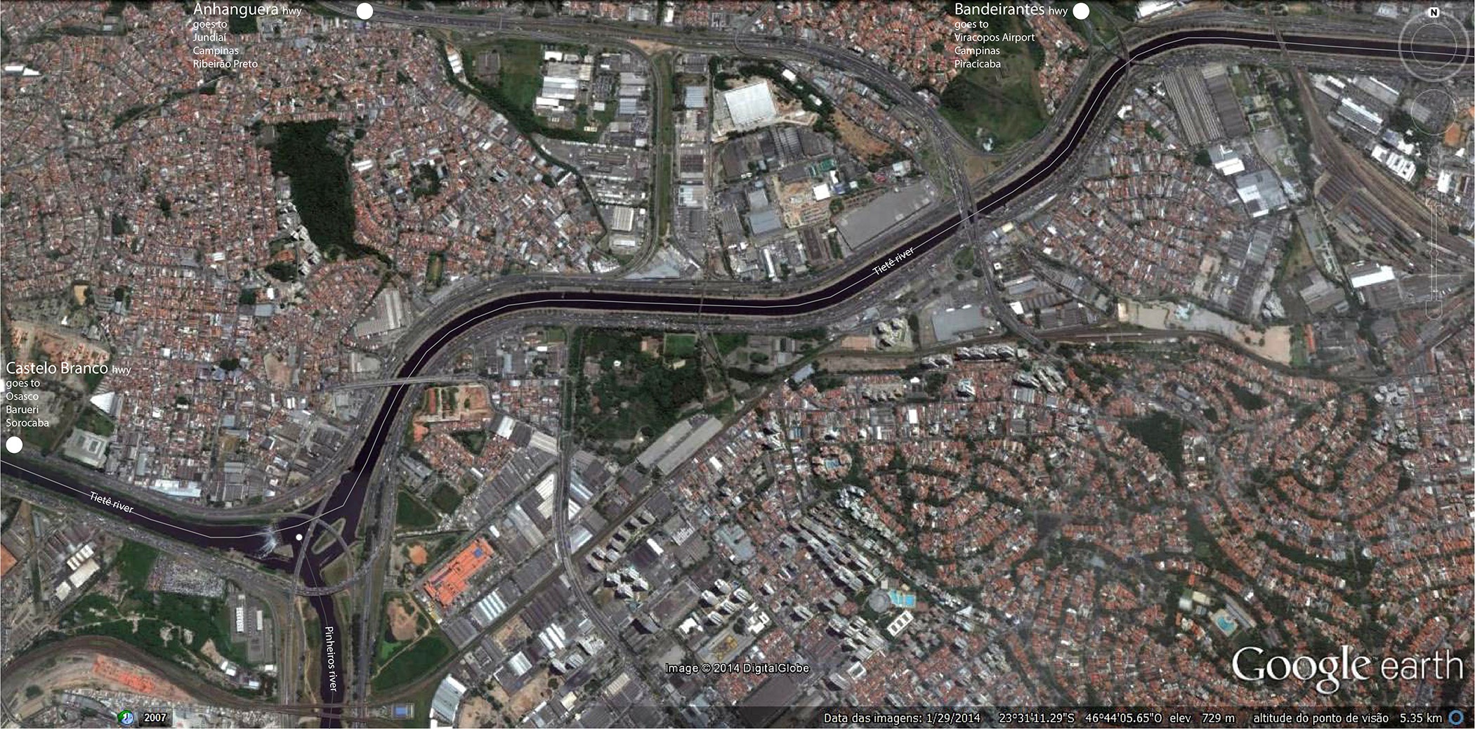
Stocks and Flows in São Paulo: people, goods and water
FC-01x Future Cities (1st Run) - Exercise 2: "Stocks and Flows"

Uploaded on 2014-11-18 by pedroveloso13
The geometry of the metropolis of São Paulo is directly connected to the economic stocks and flows since the 19th century. Railways situated the city as a central node between producers of coffee beans and the port. Today, great highways maintain its direct relationship with the economic vectors, connecting São Paulo with different nodes (cities, industries, companies, airports and universities). In the picture above, Bandeirantes hwy, Anhanguera hwy and Castelo Branco hwy are examples of these connections. 1 - 2 The picture above shows that the most important stocks and flows are transported by vehicles. Once river engineering ensured the regularity of the meandering natural flow of water, it became easier to transpose the valleys with bridges and viaducts or to drive along the rivers within large avenues. It is important to note that vehicles are the main transportation of (1) people and (2) goods between the nodes.They ensure the economic activities of the city like the circulatory system ensures the vitality of our body. People and goods spread to different locations in the city, which allows us to consider the buildings in the maps as the stocks. 3 The third stock is water. Pinheiros river flows to Tietê river under the "cebolão" (something like "big onion") viaduct complex, that contains a mobile dam. The water flows of Pinheiros are polluted, but are pumped to Billing reservoir (stock) in the south of the city. Tietê river is not only a main drainage system of the city, but it contains a series of dams along its path that utilizes its hydroelectric potential. Besides the fact that Tietê river has some navigable parts outside São Paulo, there is currently a project to transform it in a waterway ring of the city. In an optimistic future, there would be mass transportation systems connecting people and goods between São Paulo and other nodes. This could relieve current traffic jams and minimize accidents, what would unfold in an increment of regional flows. Besides, the waters will be unpolluted allowing not only to increase its contribution to water stock of the city, but also to subside transportation and "waterscapes" for leisure activities. All in all, these changes would take advantage of all potential activities of a global metropolis, increasing its resilience. [1]: https://edxuploads.s3.amazonaws.com/14163380967996022.jpg