Uploaded on 2016-04-05 by mario_ximenez
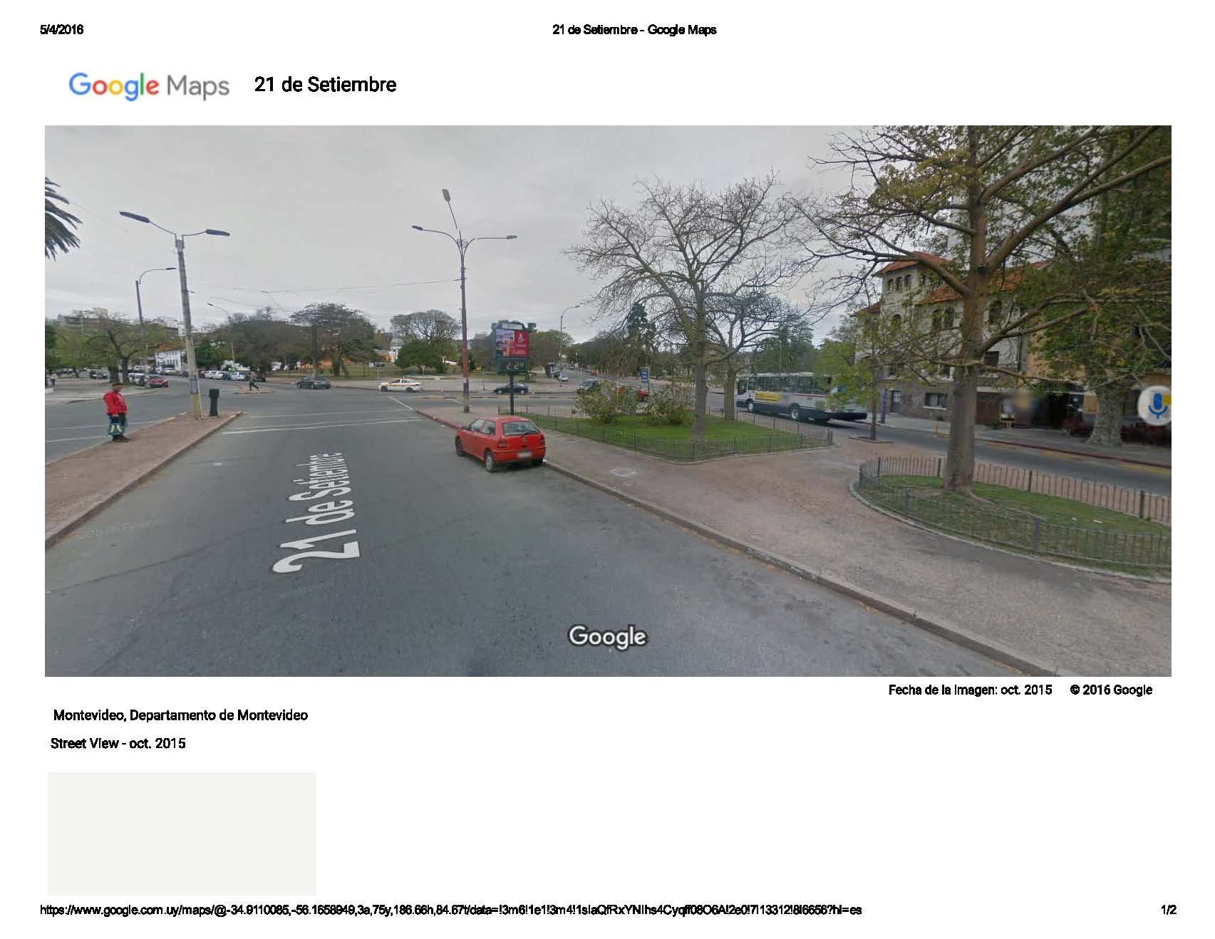
2. Country: **URUGUAY** 3. GPS Coordinates: Location **A**: Latitude: **34°54’ 38.84” S** / Longitude: **56°09’47.20” W** Altitude: **11.95 m.s.l.** Location **B**: Latitude: **34°54’ 40.17” S** / Longitude: **56°09’57.30” W** Altitude: **17.13 m.s.l.** **Location A** ![Location A][1] ![Location A2][2] ![Location A3][3] Image Google Maps Street View **Location B** ![Location B][4] ![Location B2][5] ![Location B3][6] Image Google Maps Street View 4. Describe Immediate Surroundings: **Location A**: *Main Avenue, 4-lane, with overgrown mid-rise Central sidewalk. Surrounded by buildings of 6 or more levels*. **Location B**: *Secondary Street, 2 lane, located on the side of a city park, surrounded by buildings over 10 levels*. 5. Sensor: *Two Types, IPhone App Thermometer and local Thermometer located in the street.* 6. What is the accuracy of the sensor? *Entire numbers*. **Location A: 19°C; Location B: 18°C** 7. Time of Measurement: **Location A**: *Season: Autumn. (Rainy day); Date: 2016.04.05; Time: 00:49* **Location B**: *Season: Autumn. (Rainy day); Date: 2016.04.05; Time: 00:57* 8. Setup Sensor: **Location A**: *Height above Surface: 2.5m; Distance from Buildings: Near 25 m*. **Location B**: *Height above Surface: 2.5m; Distance from Buildings: Near 35 m.* 9. Duration of Measurements: **Location A**: *5 minutes*; **Location B**: *5 minutes* 10. Weather during measurements: **Location A**: *Wind Speed: 7.5 km/h; Amount of Clouds: Cloudy after Rain.*; **Location B**: Wind Speed: 7.5 km/h; *Amount of Clouds: Cloudy after Rain* [1]: https://edxuploads.s3.amazonaws.com/14598765275797247.jpg [2]: https://edxuploads.s3.amazonaws.com/14598766876535519.jpg [3]: https://edxuploads.s3.amazonaws.com/14598770318178271.jpg [4]: https://edxuploads.s3.amazonaws.com/14598767269835166.jpg [5]: https://edxuploads.s3.amazonaws.com/14598767439022376.jpg [6]: https://edxuploads.s3.amazonaws.com/14598770504600091.jpg