Heat Island Effect in Quito, Ecuador
FC-02x Livable Future Cities ( 2nd Run) - Compulsory Exercise 2

Uploaded on 2016-04-07 by Achilles7
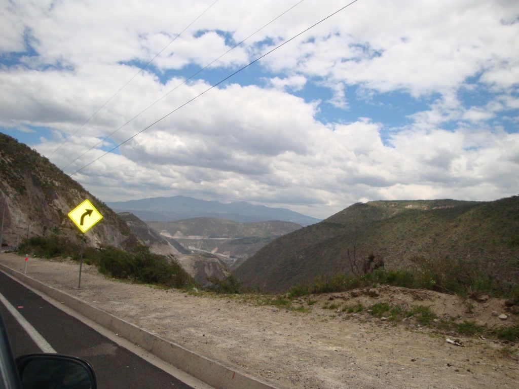
Serrano (2010) calculates the difference between the measurements registered by two weather stations to determine what could possibly be attributable to the Urban Heat Island effect in Quito. A weather station is located in Iñaquito, a commercial neighborhood in the north of Quito, and the other one in the outskirts of Malchingui, a small town at the same height as Quito. He obtains an average difference of 0.7º C. (Serrano, 2010, pp. 186-187). At noon and in the afternoon the sun usually shines and it gets hot. Without there being too many trees, the main source of shade are the buildings, so a lot of areas (Street pavements, building walls) are heated by the sun. There is also a lot of brightness, so it’s more comfortable to wear sunglasses when walking in the streets. Installment of green roofs is a recent and seldom practice, since it implies additional building expenditures. Although there are some large public parks, they are located in the vicinity of only some neighborhoods. Note on the photos: the northern surrounding area of Quito is mainly dry and warm. The southern and eastern surrounding areas are greener. ![Business District in the North of Quito][1] ![Panamericana Norte Highway - Heading Guayllabamba][2] **3. Which are the measures you would propose?** The first measure I would propose is the installment of green roofs and green areas in a massive scale. As a second measure, I would propose planting tall and leafy trees along avenues and streets together with a middle term plan to improve the quality of public transport and reduce the use of private cars, thus decreasing CO2 emissions into the atmosphere. **4. Is UHI effect concerning policy making in your area?** The Metropolitan District of Quito has taken some actions to address problems of transportation and social economy that indirectly incluence UHI. Vehicle usage restriction: based on the last number of the license plate, owners of private vehicles cannot make use of their vehicle one day during weekdays at specific hours of the day (07:00-09:30; 16:00 – 19:30) (Metropolitan District of Quito City Hall, 2010). In April 2011 this restriction caused a decrease in traffic between 8% - 12% compared to April 2010. The level of pollution also decreased by April 2011: 0,16mg/m3 in the morning and 0,05 - 0,09mg/m3 in the afternoon (Quito Public News Agency, 2011). Metropolitan Network of Bike Lanes – Ciclo Q: In 2014 Quito had 53,71 km of urban bike lanes which meant an increase of 5 times the length of available bike lanes in the city compared to the years before 2009 (Metropolitan District of Quito City Hall, 2014). However many city areas don’t have any bike lanes yet (BiciQuito, 2012). Public bikes lending service – Bici-Q: it is a free service for lending bikes within the network of bike lanes – Ciclo Q. In 2014 there were 625 available bikes and 3.000 trips per day (Gartor, 2015). Urban agriculture: 752 demonstrative and family orchards and 535 small green houses have been set up and 5,468 people have been trained in urban agriculture during the last years (Metropolitan District of Quito City Hall, 2014, p. 140). Green roofs: as part of the Quito Strategy for Climate Change, 1.500 m2 of green roofs have been set up during the last years in city hall institutions (Metropolitan District of Quito City Hall, 2014, p. 153). **Bibliography:** BiciQuito. (2012, July 31). Map of Bicycle Lanes. Retrieved April 01, 2016, from BiciQuito - Public Bikes: http://www.biciquito.gob.ec/index.php/component/zoo/item/mapa-copy.html Gartor, M. (2015, September). BiciQuito public bicycle system as an alternative for sustainable mobility: contributions and limitations. Retrieved April 01, 2016, from Digital Library of Flacso Andes: http://67.192.84.248:8080/handle/10469/7741 Metropolitan District of Quito City Hall. (2010, April 28). Resolución Nr. A 0017. Retrieved March 27, 2016, from Metropolitan Traffic Agency: http://www.amt.gob.ec/files/AMT-ORDM-305-CIRCULACION-VEHICULAR-PICO-Y-PLACA.pdf Metropolitan District of Quito City Hall. (2014, March). Management Report 2009-2014. Retrieved April 01, 2016, from Quito City Hall: www.quito.gob.ec/documents/informe_gestion_2009-2014.pdf Public News Agency of Quito. (2011, July 01). Annual Assessment of [the Regulation] "Rush Hours and License Plate" yields good results. Retrieved March 27, 2016, from Public News Agency of Quito: http://prensa.quito.gob.ec/Noticias/news_user_view/evaluacion_anual_de_pico_y_placa_confirma_buenos_resultados--3787 Quito Public News Agency. (2011, July 01). Annual Assessment of [the Regulation] "Rush Hours and License Plate" yields good results. Retrieved March 27, 2016, from Quito Public News Agency: http://prensa.quito.gob.ec/Noticias/news_user_view/evaluacion_anual_de_pico_y_placa_confirma_buenos_resultados--3787 Serrano, J. J. (2010, November). Spatial Regionalization of Monthly Climate Series. Case Study: Guayllabamba River Basin. Retrieved April 02, 2016, from Digital Repository EPN - National Polytechnic School: bibdigital.epn.edu.ec/bitstream/15000/2659/1/CD-3343.pdf **Photos:** self taken [1]: https://edxuploads.s3.amazonaws.com/14596308398437827.jpg [2]: https://edxuploads.s3.amazonaws.com/14596310584215269.jpg