Uploaded on 2015-12-15 by JoseArcila
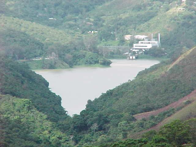
**Water:** Caracas is located in a valley with many streams that comes down from the mountains, these streams are tributaries of two main rivers: "Guri" River and "El Valle" River, both cross the city from West to East. Lamentably most part of these rivers are contaminated, so they can't provide services of fresh water or food. However "El Valle" River is exploited 8 km before it goes into the city in a reservoir called "La Mariposa", it is contained by a dam 8.700.000 cubic meters of fresh water to supply (in combination with another two reservoirs, located further away) the needs of Caracas. !["La Mariposa" Reservoir, 8 km at the southwest of Caracas. Source: Wikimedia Commons.][1] "La Mariposa" Reservoir, 8 km at the southwest of Caracas. Source: Wikimedia Commons. **Food:** The valley of Caracas has a lot of fertile lands, but they are occupied with high density urbanized zones, there are only some agricultural spaces in a suburb called El Hatillo, located at the southeast of the city. **b. Regulating services** **Climate regulation and erosion prevention:** The valley where Caracas is located is surrounded by mountain ranges with dense vegetation, these have a big importance in the carbon sequestration, the maintenance of a temperate climate, and the prevention of erosion of the mountainslides. The most noteworthy example of service regulator, is the National Park Warairarepano, locally knowned as "El Ávila" Hill, it is a big mountain and forest reserve that limits the north of the city and divide it from the coast. ![Forested mountains around the valley of Caracas. Source: Wikimedia Commons][2] Forested mountains around the valley of Caracas. Source: Wikimedia Commons **c. Habitat or Supporting services:** The mountain knowned as "El Ávila", at the north of the city is an important **reservoir of wildlife** and is habitat for a big variety of endemic species (specially birds) that could be displaced by the urbanization of the valley. This mountain is also connected with a range of other mountains near the north coast of the country.. ![Bird from Warairarepano National Park. Source: Wikimedia Commons][3] **d. Cultural services** Recreation, sports and tourism: In addition to regulating and habitat-supporting services, "El Ávila" is a symbol of Caracas, it is recognized from almost all the districts of the city, and has an important role on the sense of place, it is a "milestone" that always indicates the north. It supports many recreative and sport activities, like cycling, walking through mountain trails and camping in some places. It is the main touristic attraction of the city too, since it has a cable car that connects the city with the top of the mountain, where are viewpoints to both sides (valley and coast) and where is located the "Humbold Hotel", an architectonic and historic landmark. ![View of Caracas, from "El Ávila" cable car. Source: Wikimedia Commons][4] View of Caracas, from "El Ávila" cable car. Source: Wikimedia Commons ![Humboldt Hotel, at the top of the mountain. Source: Wikimedia Commons][5] Humboldt Hotel, at the top of the mountain. Source: Wikimedia Commons [1]: https://upload.wikimedia.org/wikipedia/commons/6/63/Embalse_de_La_Mariposa.jpg [2]: https://upload.wikimedia.org/wikipedia/commons/7/73/El_Valle_de_Caracas._Distrito_Capital,_Venezuela..jpg [3]: https://upload.wikimedia.org/wikipedia/commons/4/49/Ave_de_Montala.JPG [4]: https://upload.wikimedia.org/wikipedia/commons/3/3e/Teleferico_waraira_repano.JPG [5]: https://upload.wikimedia.org/wikipedia/commons/d/da/Hotel_Humboldt,_vista_general.JPG